Analysis
Analysis
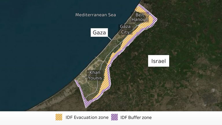
Satellite images reveal thousands of new tents near Gaza border area under Israeli evacuation order
An evacuation map was issued just hours after the Israeli military began its "large-scale attack" in Gaza that has reportedly killed over 400 people, throwing the ceasefire into chaos.
Image:
The evacuation zone covers large areas of the Gaza Strip including the buffer zone
Stay ahead of the curve with our up-to-the-minute news coverage. We deliver breaking news alerts, in-depth features, and engaging multimedia content to keep you informed and connected to the world around you.


